Lost and Found with a Christian Cartographer
Blog / Produced by The High Calling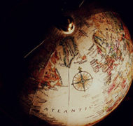
“Are we still on the right course, Christina?”
“Pretty much.”
“Pretty much,” I asked, “or definitely?”
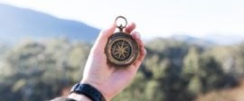
We had been bush-whacking toward a trail marker for nearly a quarter of a mile and she was the one with the compass. The trick—once you’ve determined exactly where you want to go on a forest map—is to aim with your compass at a distant but clearly visible tree, then walk to that tree, aim at the next distant but visible tree, then walk to that tree as well. And so on, essentially connecting a laser-straight line of dots until you reach the destination. I say laser-straight, because according to the Outward Bound Map and Compass Handbook, “For each degree that your course is in error and each mile that you travel, you’ll be off by 92 feet.”
Christina looked at me playfully. “Seriously…it’s not that important, is it? I mean, we’re pretty much headed in the right direction.” That’s when I saw the trail marker a good ways to our left. She didn’t, and I decided not to tell her. So we passed by.
Not knowing what you don’t know
James Whitacre, a cartographer and young professionals coach here at The High Calling, believes that “successful people are able to uncover the information that they don’t know that they don’t know.” It’s one thing to know what you don’t know, but to not know what you don’t know? Where do you even begin?
James begins with maps.
“Before 2005,” he says as a way of example, “conventional shale wells in Pennsylvania were relatively small, some so tiny you might not notice them as you walk by. On the other hand, unconventional wells were deep and big. I made a map showing the footprints of both types. When a geologist looked at the map, he didn’t actually believe what he saw. The map revealed a different pattern than what he had expected; it revealed that he didn’t know what he didn’t know.”
In a way, Christina didn’t know what she didn’t know either.
But I was there for Christina. I had taught her, handed her the compass and map and asked her to get us from point A to point B. I was her coach. James is in a season where he often has to find his own way. When I asked if this was due to his workplace, he said yes, but then changed his response. “It is because of my work environment, but not just mine. It’s hard for a lot of people to find good mentors.”
At 31, James could still be considered a young professional. He certainly doesn’t claim to have arrived. “There are so many things that I’m simply and completely unaware of. Maps are one way for me to discover what I don’t know.”
Paying attention to the details
James loves maps. In fact, he can say like Eric Liddell in Chariots of Fire, “And when I make maps, I feel God’s pleasure.” He loves compasses and bearings and all of the data a map can offer. But data is only as helpful as the person who can interpret it. “Maps speak a language,” he says.
Readers, consider the following maps (Click on the image to view it enlarged). What can you tell by looking only? Besides the conveyance of beauty and mystery, is there any language to interpret, and how would you know what it was without more information?

On the left is a hypsometric map, where the coloring displays relative elevation (white high; green low). On the right is a slope map, where white shows steep slopes and the black, less steep. Maps are dependent on a scale and a legend. Without such tools, as is the case in these examples, the language "spoken" is only relative—no quantifiable data exists. But even these naked maps are not void of data entirely. Click on the image to see if you can spy the Pennsylvania Turnpike.
Map bazaar
I had the chance to visit James’ workplace. He opened my eyes to the range of maps. There is the shale well example, and the travel map example in Christina’s story. There is a map to confirm what forest ecology literature often claims regarding sugar maples prefering south-facing slopes and red maples prefering north-facing slopes. And there is the bathymetry map James created in a boat.
“We wanted to see the depths of a lake in Yellow Creek State Park. So we got a boat, equipped it with a sonar depth-finder and a GPS and basically trolled the lake. Imagine mowing the lawn. Back and forth, back and forth, across the lake. Using interpolation, we were able to create a topographical map of what’s under the surface of the water, including fish habitat structures. Then we sold it to fishermen."
Your contribution to the world?
“It provided a fishing map for those without depth-finders. They could buy the map for quite a bit less.”
I asked James why it’s important for him to be out-of-office whenever possible. I thought he’d talk about nature and fresh air and play, but he took an alternate route.
“The outdoors gives me two different perspectives. On a map, I might only see an area marked by tree cover. But outside, I can see the actual species that form the canopy. If I add what I see to the map and then process the data, I might learn, ‘Oh, those maple trees make up nearly 80% of the coverage in this stretch of the woods.’ One perspective feeds the other.”
When I asked what direction James might offer to a young professional, he continued on this same thread. “Pay attention to the details while also maintaining a view of the bigger picture. You can't have one without the other.”
In other words, don’t miss the forest for the trees. But, as Christina learned, the trees matter, too. ![]()
Other out-of-office articles:


The Accidental Executive: Lessons on Business, Faith, and Calling from the Life of Joseph
Look beyond Joseph's coat of many colors and discover that he holds surprising insights for today's workplace! Examining Joseph's experiences as a slave, a prisoner, and the CEO of a food company in Egypt, author Al Erisman illustrates how the life of this biblical patriarch can teach us lessons for use in modern business, government, and education.